


USFS Wildland Fire Assessment System


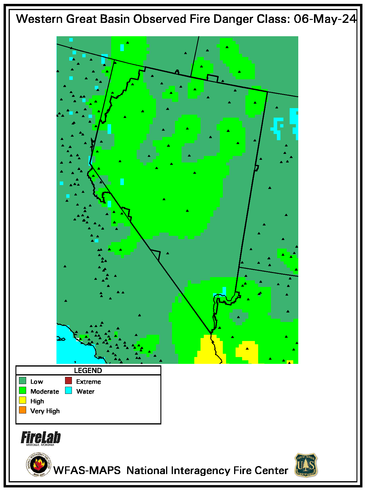
Regional Maps - Observed Wildland Fire Potential
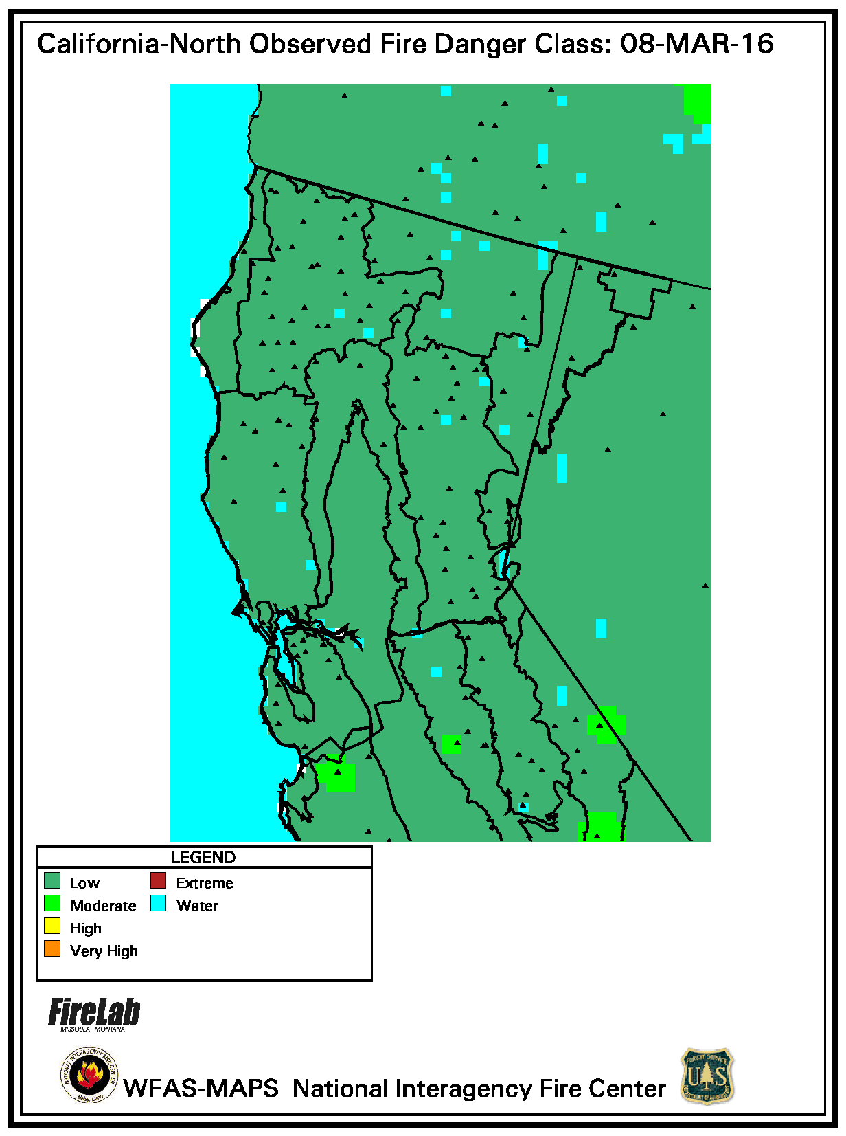
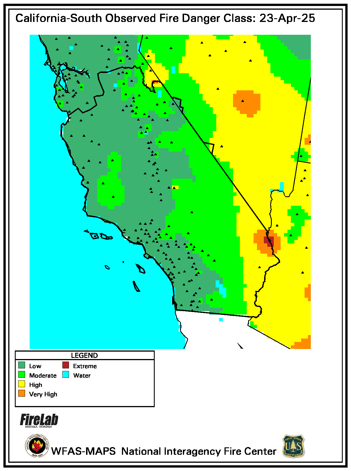
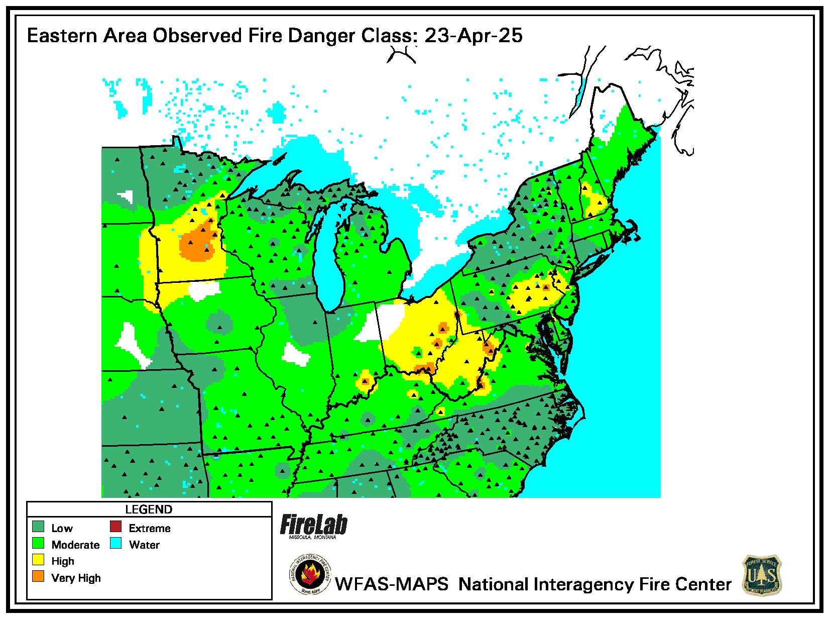
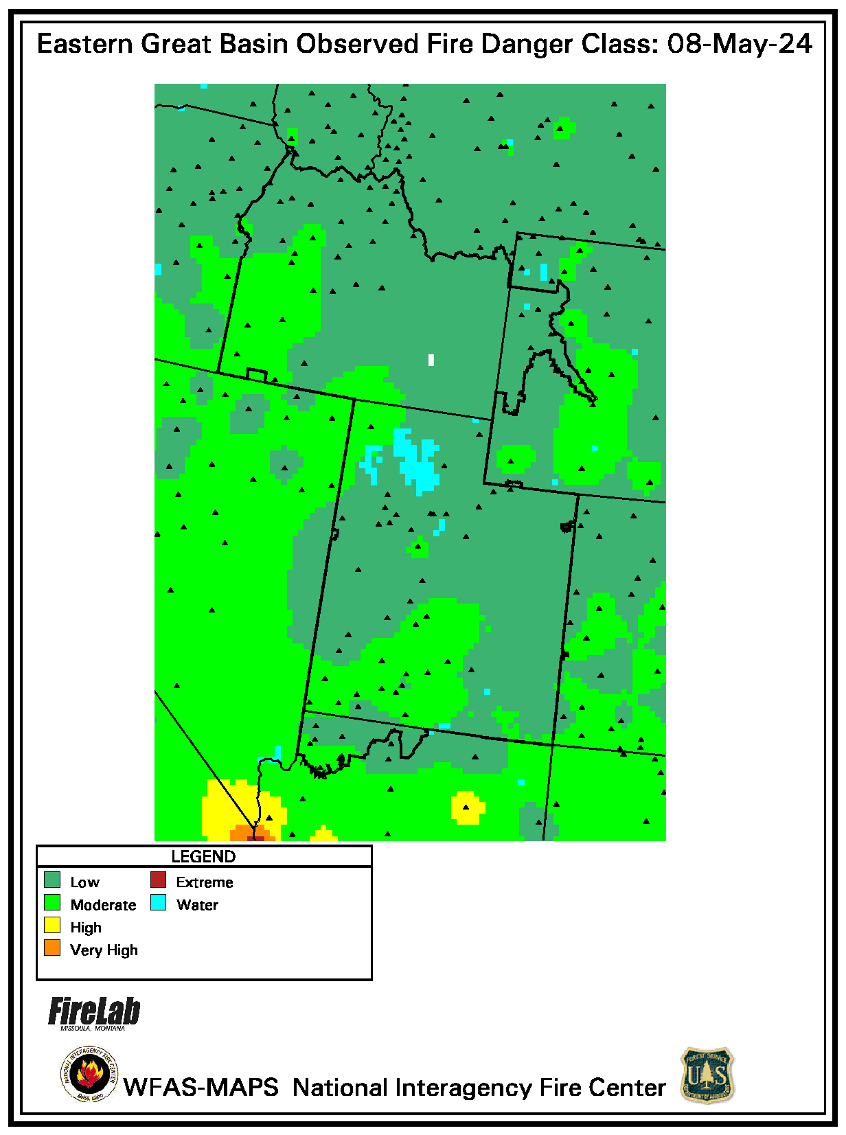
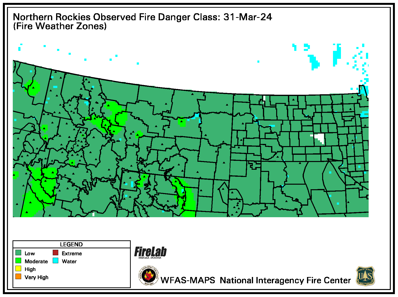
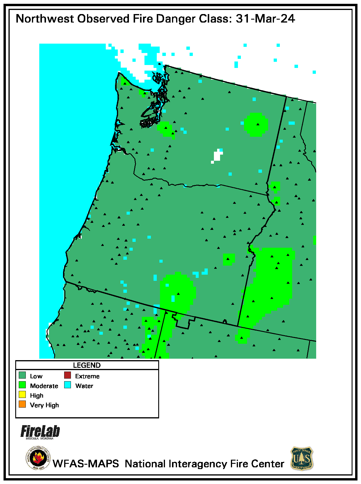
N. Calif. | S. Calif. | East | E. Gt. Basin | N. Rockies | North West
South | Rocky Mt. | South West | W. Gt. Basin


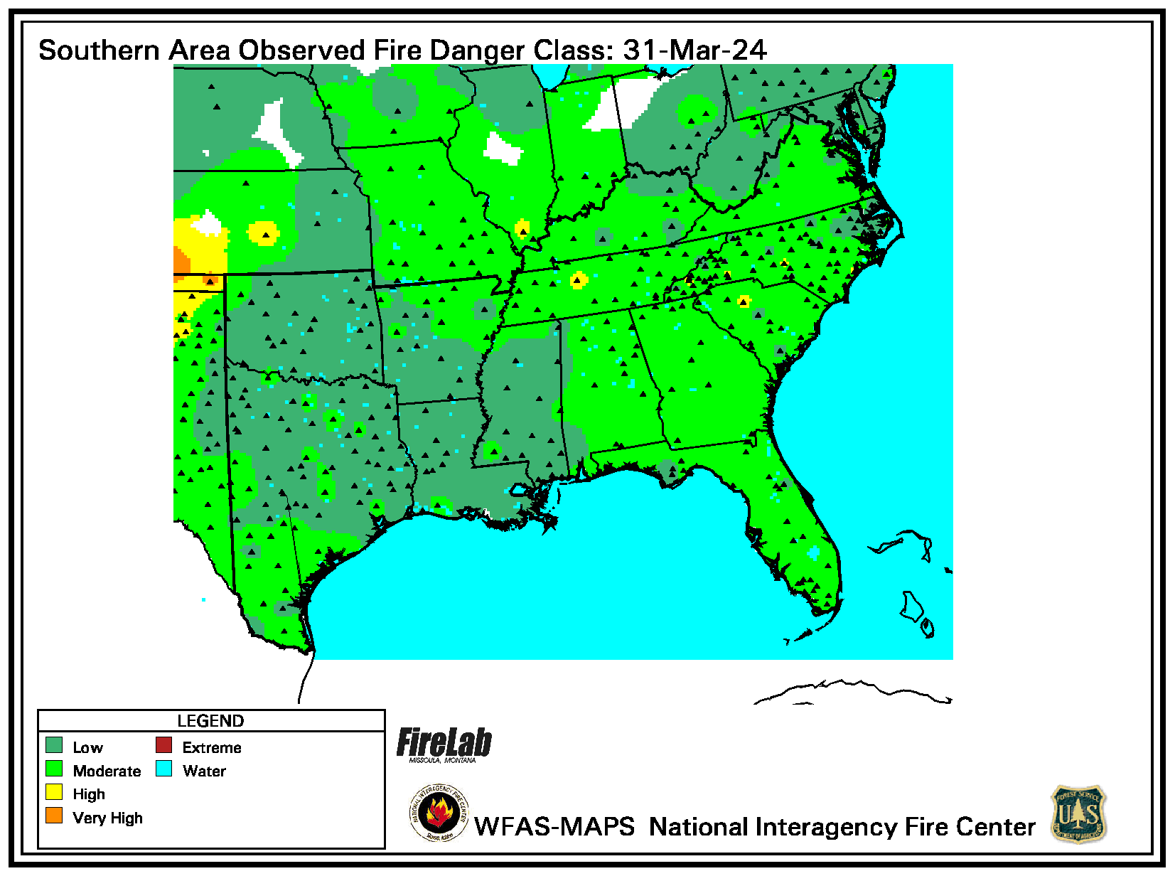
South | Rocky Mt. | South West | W. Gt. Basin
(Click a link to display a new chart.)
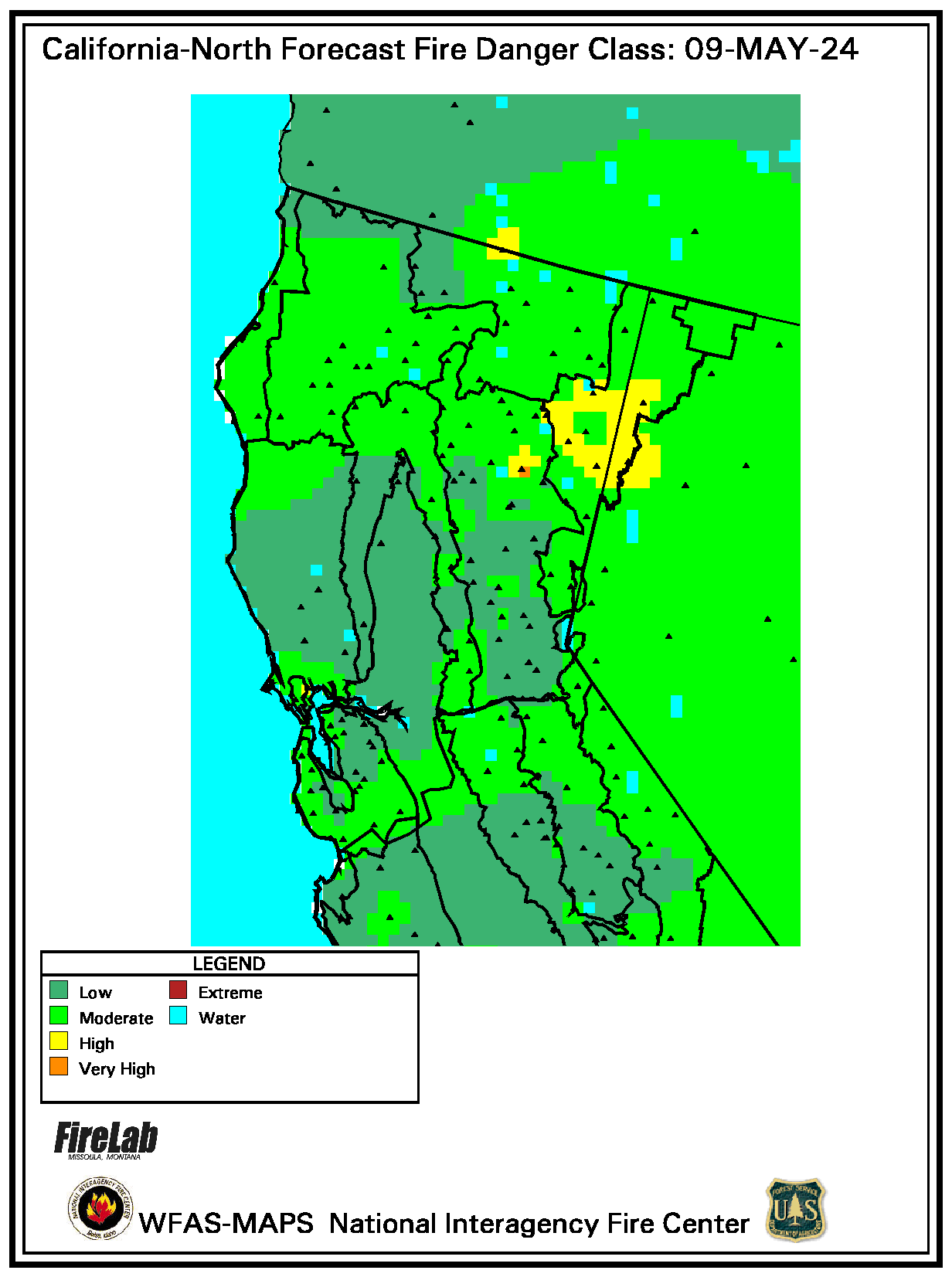
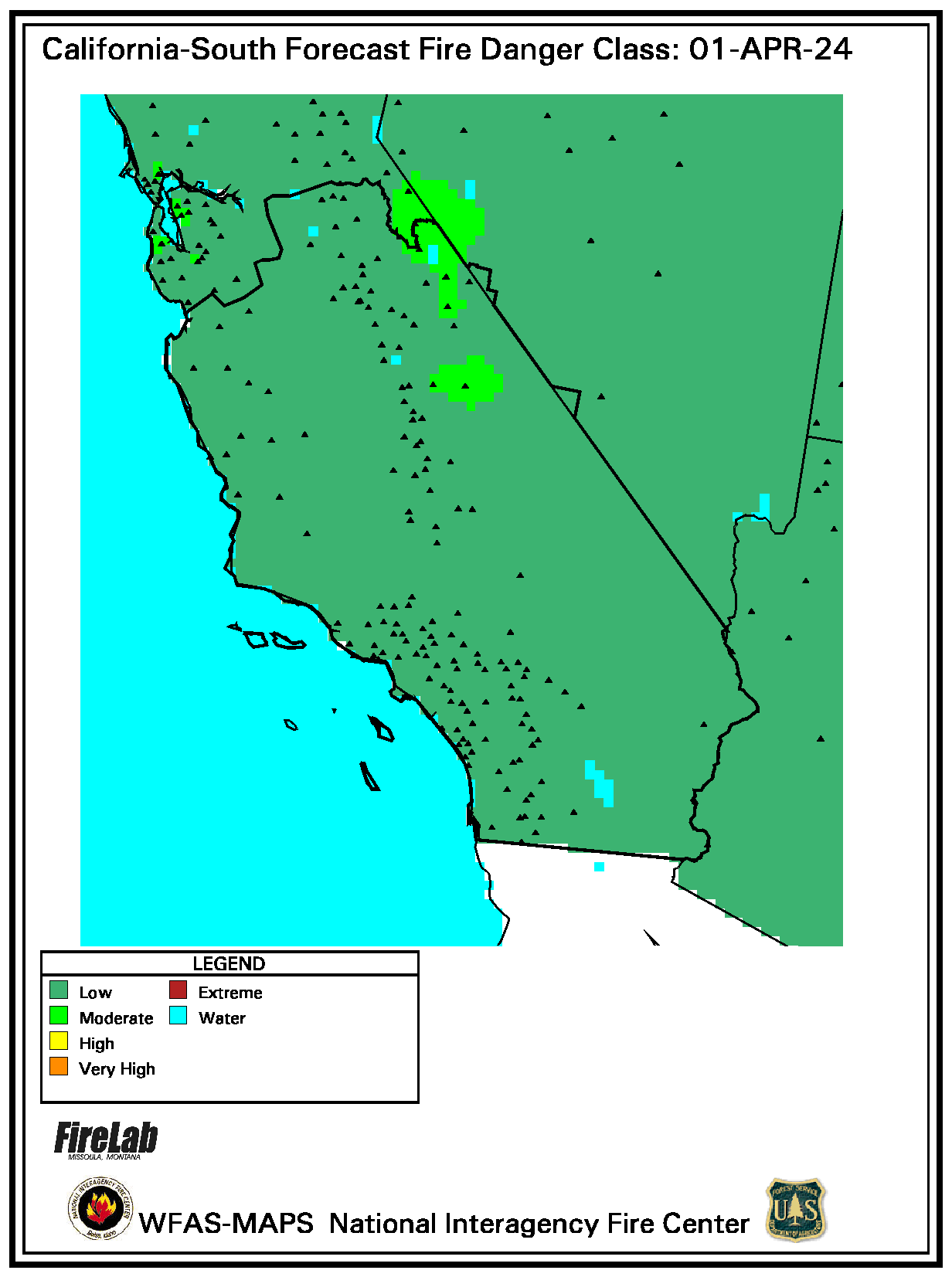
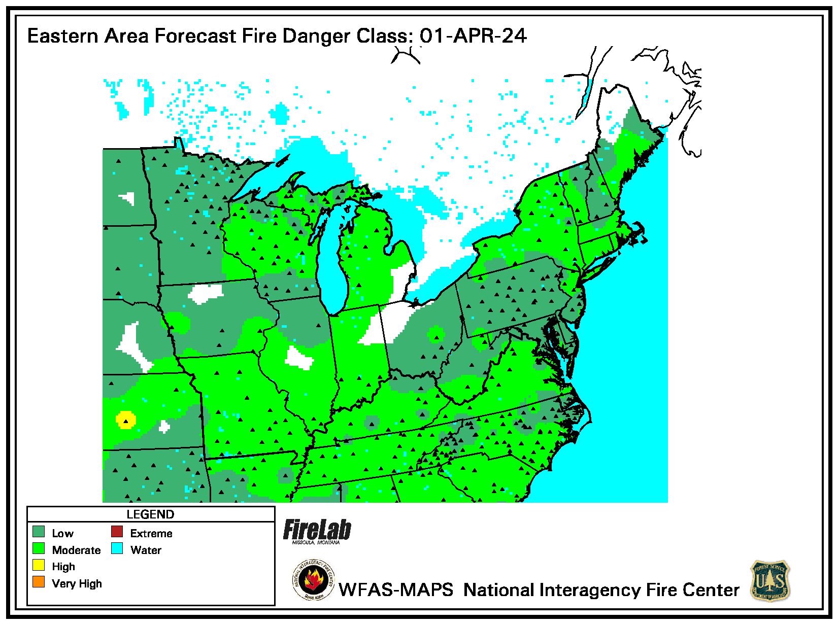
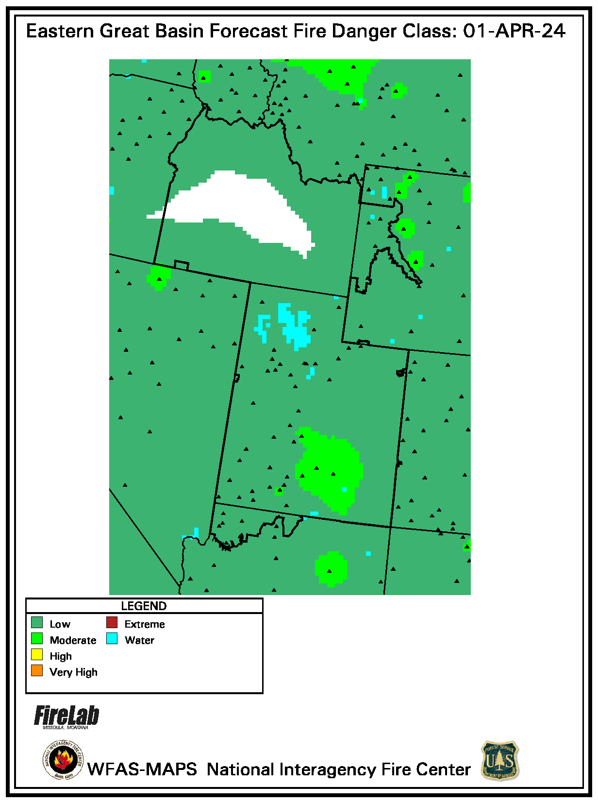
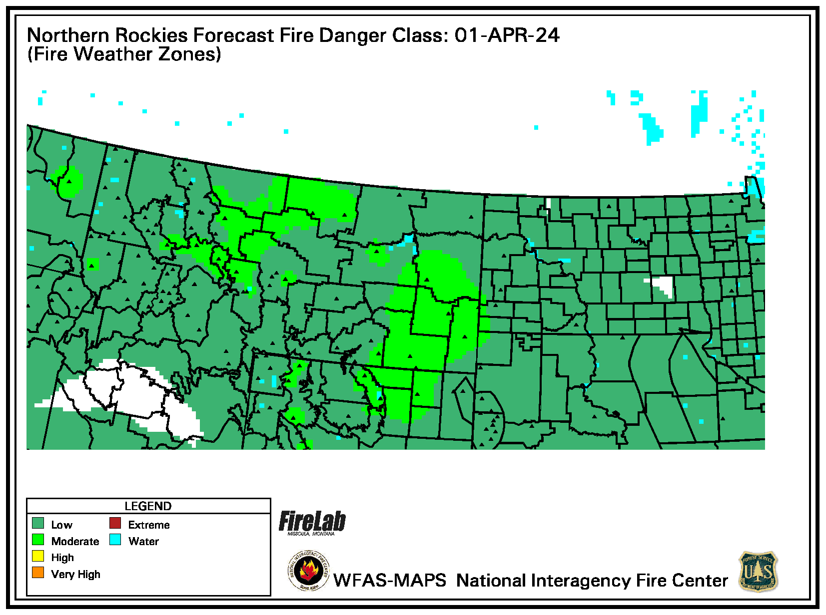
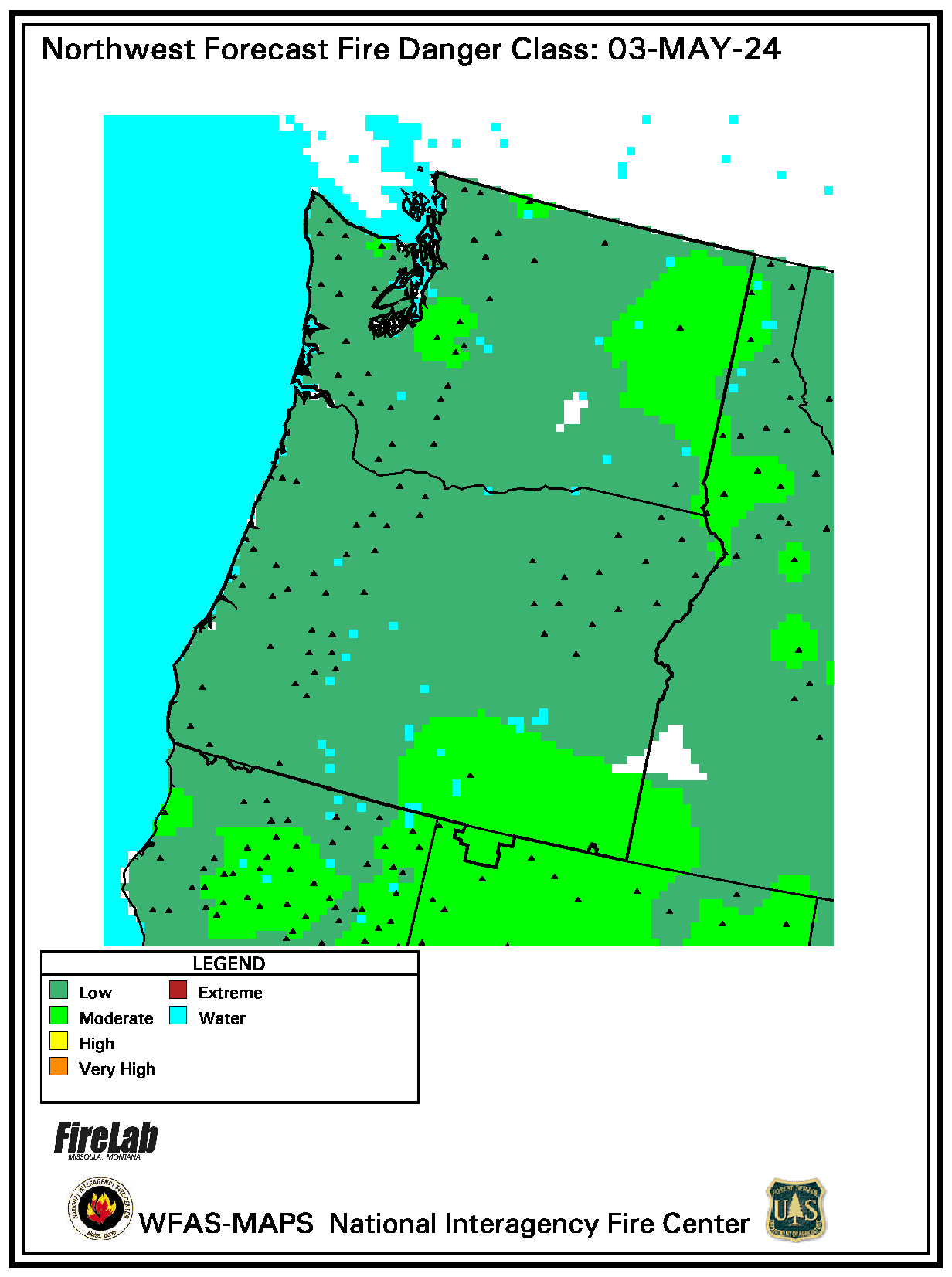
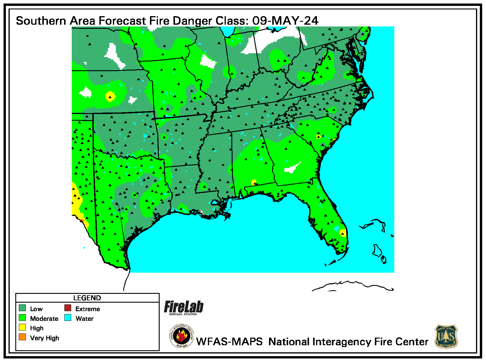
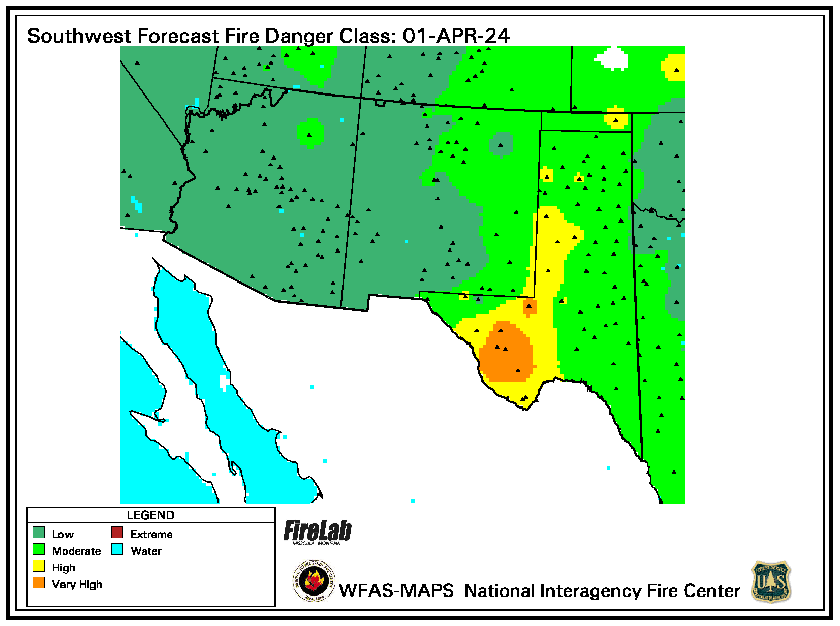
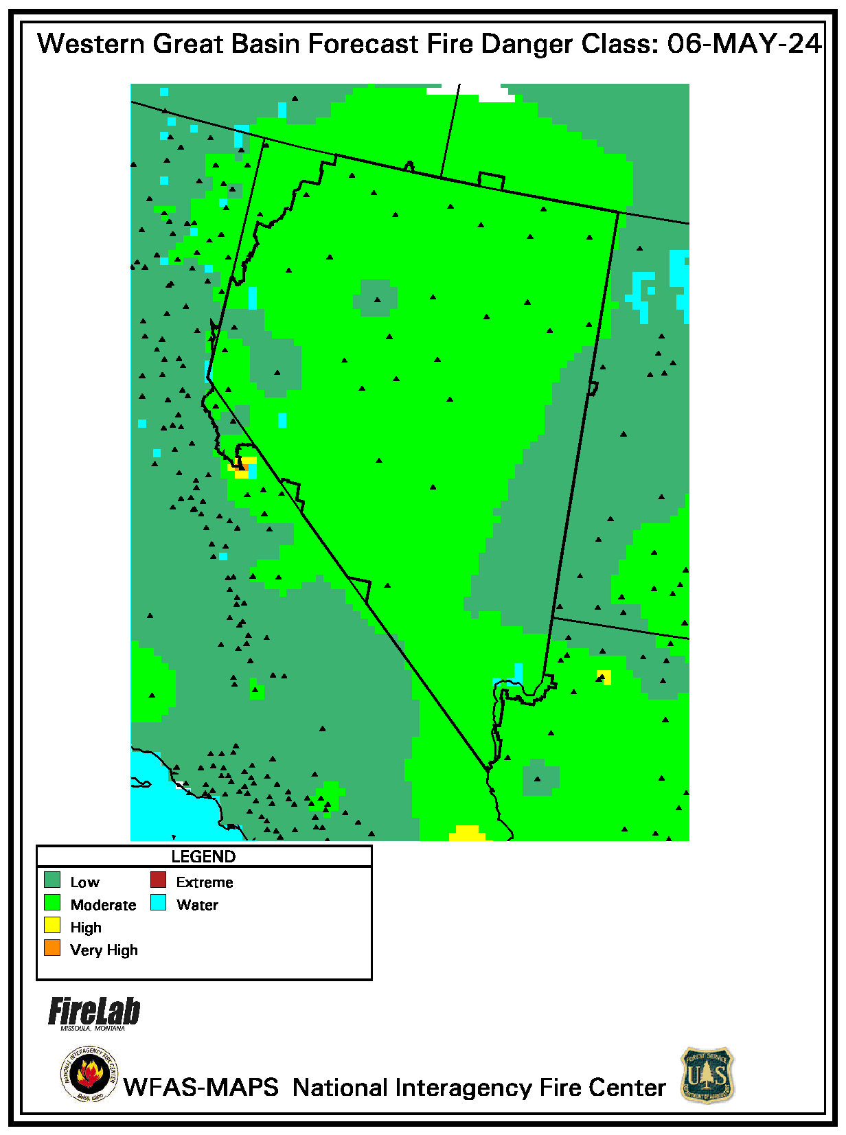
Regional Maps - Forecast Wildland Fire Potential
N. Calif. | S. Calif. | East | E. Gt. Basin | N. Rockies | North West
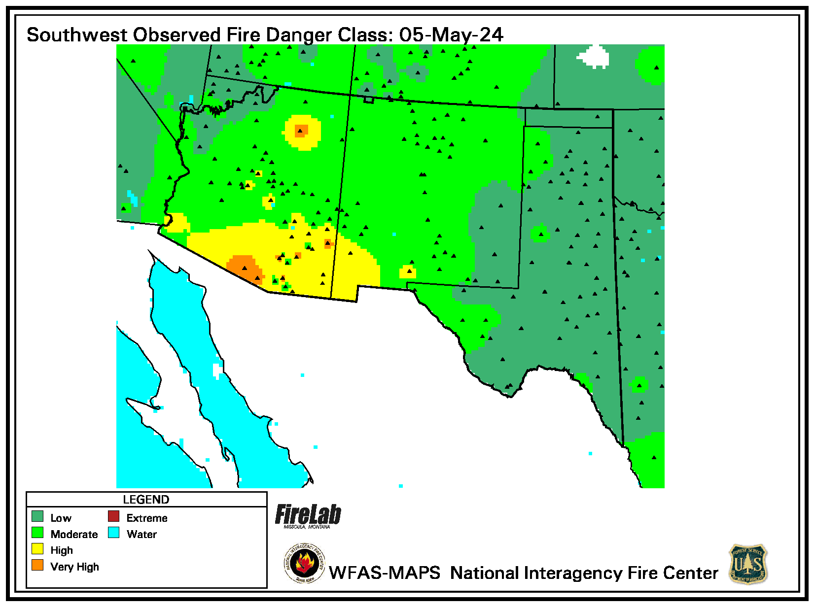
South | Rocky Mt. | South West | W. Gt. Basin

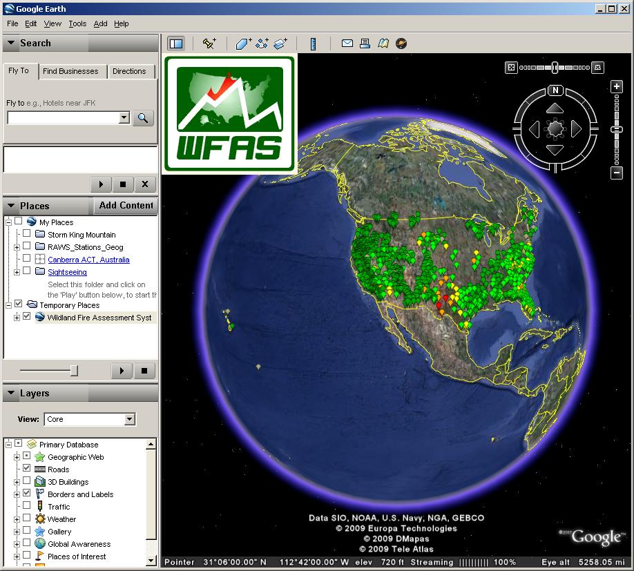
Click here to download the WFAS Google Earth Map Data file in KMZ format
or
Click here to download the auto-updating KML file
If you don't have Google Earth installed on your computer, you can download it here free of charge:
http://earth.google.com/
South | Rocky Mt. | South West | W. Gt. Basin
(Click a link to display a new chart.)
Google Earth Map Data
WFAS is now offering point-based map data in a Google Earth compatible format. The files are updated daily and include current weather, fire danger and fuel moisture observations as well as forecast weather conditions when available. More WFAS products will be made available in this format in the future, so keep checking back.
NOTE: The WFAS map data KML now includes links to historical weather data for each operational weather station. Just follow the links at the bottom of the marker page.
The daily rain/dry lightning map has been added to Google Earth products. The KMZ link is in the Current Condition box under Experimental Products (Dry Lightning). The map date is found in the folder description for the product. (December 2010)
Click here to download the WFAS Google Earth Map Data file in KMZ format
or
Click here to download the auto-updating KML file
If you don't have Google Earth installed on your computer, you can download it here free of charge:
http://earth.google.com/
Maps and Data Courtesy of US Forest Service Wildland Fire Assessment System.